Research and Development
Always researching more ways to show you more of our earth
The field of remote sensing applications is extremely broad. In order to apply observation data to these fields, it is necessary to conduct a wide range of research activities ranging from fundamental research on the observation of target objects to applied research corresponding to application needs, including combination with other information sources. There is also a need to develop technologies for the storage and processing of data obtained through satellite observation, as well as application technology and systems for data usage.
RESTEC has continued to conduct research ranging from fundamental research such as studies on the reflective properties of target observation objects, to applied research in the areas of environmental monitoring and management of forests, water resources, the atmosphere, and oceans, food safety and security, disaster prevention, development of information on national land and infrastructure, and other fields of data application. At the same time, it is engaged in the development of calibration technologies such as radiometric and geometric calibration of observation data, the development of ground systems for the reception, processing, and storage of satellite data, as well as the development of software such as data application systems that incorporate the latest trends in technology, including Open GIS Consortium (OGC) and International Organization for Standardization (ISO). In addition, it is engaged in the development of remote sensing equipment.
In the future, RESTEC aims to keep up these research and development activities, and contribute to the development of remote sensing by harnessing the experience it has built up thus far.
-
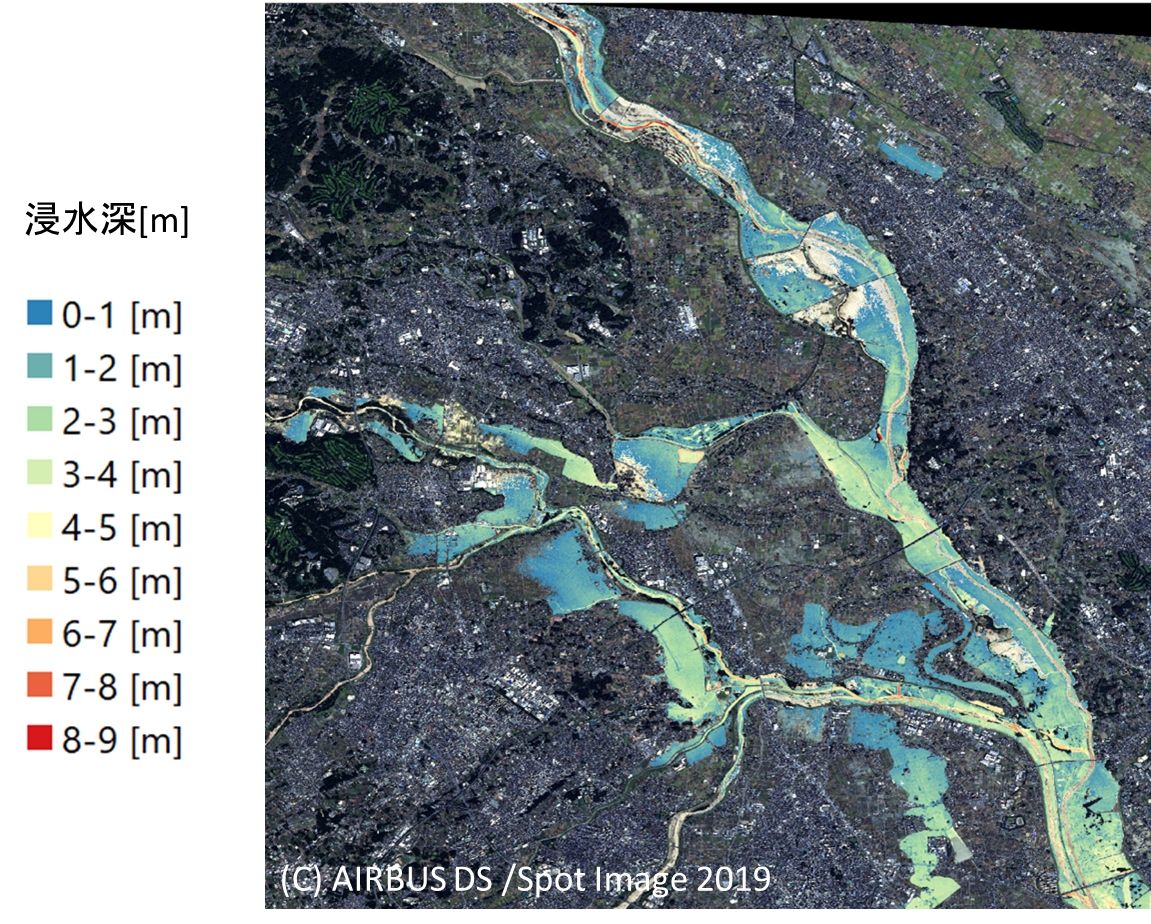
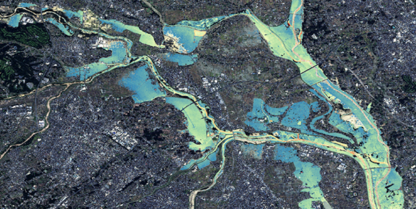 Mapping of Inundation Depth Estimated from Satellite DataUseful for addressing flood damage caused by the collapse of river dams/embankments due to localized downpours that are increasing in frequency throughout Japan
 -
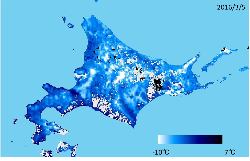
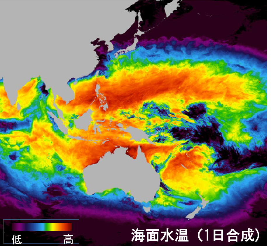
 Research on High-Quality Products Using the Himawari Meteorological SatelliteFor use in agriculture, water resources, large-scale disasters, snowfall, precipitation amount, sea surface temperature, red tides, and much more
 -
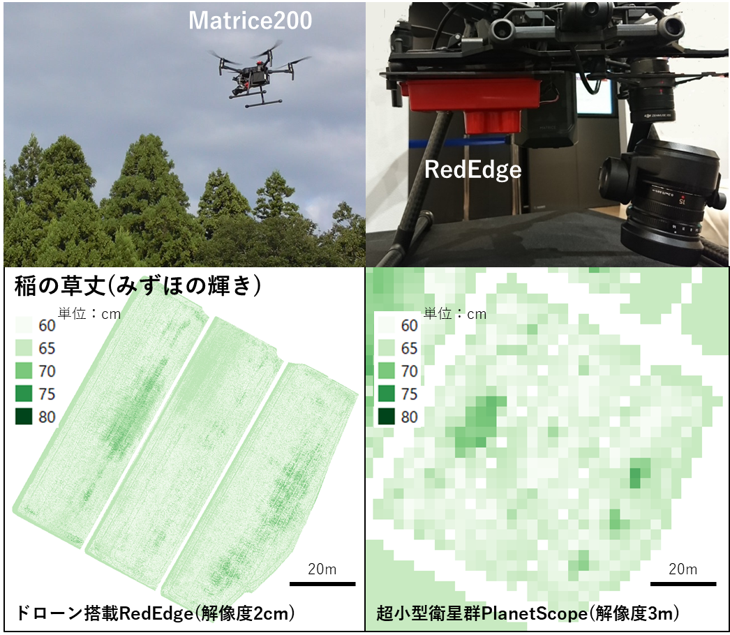
 Smart Agriculture Using Satellites and DronesResearch and development of remote sensing technologies using satellites and drones for smart agriculture
 -
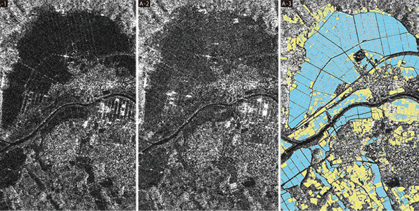
 InfrastructureDetecting Dangerous Spots in Social Infrastructure in their early stages. Contributing to Ensure a Safe, Secure and Robust Society
 -
 AgricultureUsing Satellite Data to Vitalize Agriculture and Solve the Problem of Food Shortages
 -
-
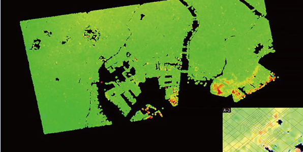
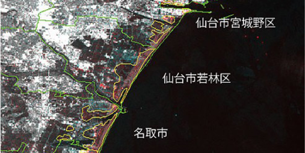 DisasterMinimizing Flood Damage by Ascertaining the Movement, Spread and Amount of Water
 -
In recent years, a surge in localized downpours has caused flood damage due to the collapse of river dams/embankments throughout Japan.
Flooded areas can be extracted using satellite images (SAR, optical) taken after a downpour. Combined with high-definition elevation data, the inundation depths of various locations can be calculated.
RESTEC uses the Japan Meteorological Agency’s Geostationary Meteorological Satellite Himawari-8/9 (2016 to present) for research of high-quality products and development of applications.
Himawari-8/9 has as many as 16 observation wavelength bands from visible to thermal infrared bands, and features high time resolution observations of Japan’s periphery at 2.5-minute intervals.
Products using Himawari are expected to be utilized in agriculture, water resources, large-scale disasters, snowfall, precipitation amount, sea surface temperature, red tides, and much more.
Research and development of remote sensing technologies using satellites and drones for smart agriculture