Minimizing Flood Damage by Ascertaining the Movement, Spread and Amount of Water
Around 70% of disasters around the world can be attributed to water, such as through flooding. For successful rescue operations and in mitigating secondary disasters, quick and accurate ascertainment of such situations is an absolute must. SAR images allow observation even at night or in rough weather, to understand the movement, spread and amount of water. This not only contributes to emergency responses, mitigation of disasters and restoration work, but it can also contribute to risk aversion in disasters and in business.
Aya Yamamoto, Disaster Team Leade
Capturing the Flood in 3D → Paving the Way to Recovery and Restoration
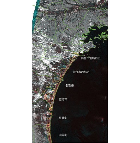
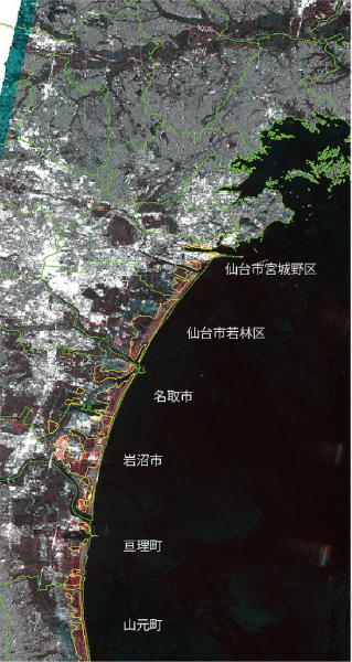
When areas are flooded or submerged as the result of tsunamis or other disasters, ascertaining the locations and amount of the floods, and whether areas are accessible on foot or by car can save lives. After the Great East Japan Earthquake, information on flooded areas gained from images was provided to the Prime Minister’s Office and disaster prevention administrative agencies, contributing to restoration work.
Obtaining information not only on the surface area, but also the depth of inundation, will enable a more accurate estimation of the number of drainage pumps required. Therefore, research is currently being carried out on ways to obtain three-dimensional information. This technology could be used not only in Japan, but also throughout Asia.
This is a diagram of the flooded area after the Great East Japan Earthquake ? the flooded area is enclosed in yellow. This information was provided to the Prime Minister’s Office and disaster prevention administrative agencies, contributing decision-making for how many pumps were required to drain water from the inundated areas, which areas had to be prioritized, and the formulation of restoration plans.