Using Satellite Data to Vitalize Agriculture and Solve the Problem of Food Shortages
In recent years, typhoons, localized downpours, droughts and other extreme forms of weather phenomena have tended to occur with greater frequency. Our objective is to enable quick responses to a variety of situations, and contribute to the stable food supply by using satellite data to grasp an understanding of the current situation and predict the status of crops.
Toshio Okumura, Agriculture Team Leader
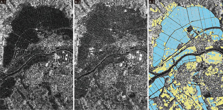
This is an image of rice fields taken with a microwave sensor from an earth observation satellite.
Image (A-1) appears dark before planting. It retains its dark appearance for some time after planting (A-2), but as the crops grow the image becomes brighter. The rice field map (A-3) has been completed by analyzing the images from these two seasons. The blue indicates paddy rice, and the yellow indicates other plants.