Sentinel-3A / 3B / 3C / 3D
国籍:ESA 欧州宇宙機関,EU 欧州連合 衛星種別:気象・地球観測衛星 打ち上げ年:2016年
概要
| Sentinel-3A | Sentinel-3B | Sentinel-3C | Sentinel-3D | |
|---|---|---|---|---|
| 打ち上げ日 | 2016年2月16日 | 2018年4月25日 | 2026年(予定) | 2028年(予定) |
| 運用状態 | 運用中 | 運用中 | 計画 | 計画 |
| Copernicus: Sentinel-3 - Global Sea/Land Monitoring Mission including Altimetry | |
| ESA, EUMETSAT | |
| 3Aおよび3Bの2機のコンステレーションとして現在運用されている。これらの次期衛星として3Cと3Dの準備が進められている。海洋、陸地、河川、湖、陸氷、海氷、大気を体系的に計測し、地球規模の気候現象をモニタリングする。 | |
| 太陽同期軌道 | |
| 814.5 km | |
| 100分 | |
| 98.6度 | |
| 10:00 | |
| 27日 | |
| https://sentinels.copernicus.eu/web/sentinel/copernicus/sentinel-3 https://eoportal.org/web/eoportal/satellite-missions/c-missions/copernicus-sentinel-3 https://space.oscar.wmo.int/satellites/view/sentinel_3a |
搭載機器・機器タイプ
DORIS (Doppler Orbitography and Radiopositioning Integrated by Satellite) 衛星測位システム /GPS (GPS Receiver) /LRR (Laser Retro-Reflector) /MWR (Micro-Wave Radiometer) マイクロ波放射計
| 全球カバレッジ(平均観測幅30 kmの場合は1カ月、100 kmの場合は10日) | |
| 20 km | |
| 23.8 / 36.5 GHz(2チャンネル) |
OLCI (Ocean and Land Color Imager) 中分解能イメージングスペクトロメータ
| 1440 km | |
| 300m | |
| 0.4 - 1.0 μm(21チャンネル) |
SLSTR (Sea and Land Surface Temperature Radiometer) 可視赤外イメージングマルチスペクトル放射計
| 1400 km(直下観測) 740 km(デュアル観測) 全球カバレッジ:1日 (MWIR/TIR)、2日 (VIS/NIR/SWIR) デュアル観測:2日 (MWIR/TIR)、4日 (VIS/NIR/SWIR) |
|
| 0.5 km(可視~短波長赤外) 1 km(中間赤外~熱赤外) |
|
| 中心波長(μm):0.555、0.659、0.865、1.375、1.61、2.25、3.74、10.85、12(9チャンネル) 火災検知バンド(μm):3.74、10.85 |
SRAL (Synthetic aperture Radar Altimeter) 2周波(Cバンド、Kuバンド)直下観測高度計
| 全球カバレッジ(平均観測幅30 kmの場合は1カ月、100 kmの場合は10日) | |
| 20㎞(IFOV) 300m (SAR Along Track Mode) |
|
| Kuバンド(13.575 GHz, バンド幅:350 MHz) Cバンド (5.41 GHz, バンド幅:320 MHz) |
衛星主要諸元
| Rockot/Briz KM(3A, 3B) | |
| 1250 kg | |
| 2100 W | |
| 3.7 x 2.2 x 2.2 m | |
| 7年 |
-
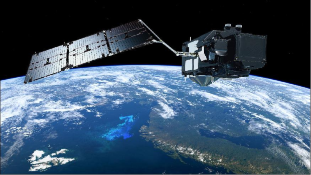
衛星概観図 (image credit: ESA/ATG medialab)