Upgrading to a new version 1.2 - Satellite image analysis application "VEGA"
2022.08.05
Information
-
Provided by RESTEC, the free application "Visualising Earth tool by Google Earth Engine Apps (VEGA)" has been upgraded (version 1.2).
This tool is for displaying Landsat-8 and Sentinel-2 data at a specified period with the color composition and reducer of your choice.
In addition to the above, "version 1.2" can see the past earth observation data taken by Landsat (4, 5, 7) and the newest date of Landsat-9, which launched in 2021.
Both Landsat and Sentinel data cover both surface and upper-atmosphere reflectance.
This updating allows users to visualize historical data going back to 1982. Moreover, Landsat data from October 2021 onwards can be visualized for both Landsat-8 and -9 together, with a frequency of one observation every eight days.
For various information on VEGA, please refer to the following Related Links. -
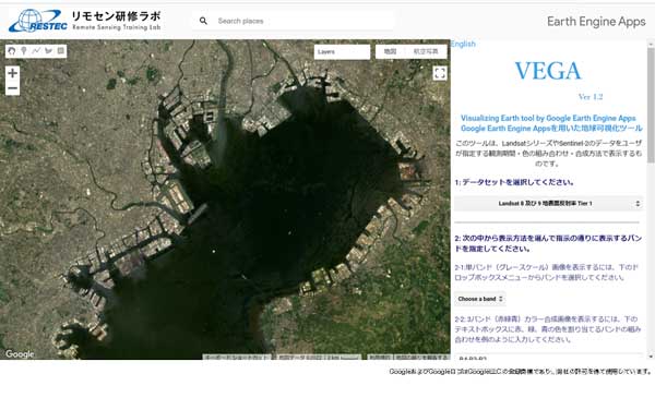
Image - Operation screen VEGA