"Remote Sensing for Beginners English Edition" on YouTube – available for free.
2021.03.30
Information
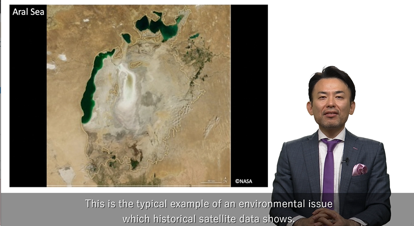
The course, "Remote Sensing for Beginners", consists of five chapters that will help those who are interested in remote sensing but are not familiar with it. The course will help to easily learn remote sensing.
Instead of theory or formula, we will explain how remote sensing works, display various images, and show you how to get data through a demonstration.
The instructor for this video is Mr. Masatoshi Kamei, Solution Service Department Ⅱ, who has been involved in public awareness and utilization promotion activities of remote sensing for many years.
The structure of the video is as follows.
・Chapter 1 "What is Remote Sensing"
・Chapter 2 "Satellites"
・Chapter 3 "Orbit"
・Chapter 4 "Utilization"
・Chapter 5 "Data Access"
RESTEC's dedicated training website, "Remote Sensing Training Lab", offers a variety of learning contents; from introductory level to practical use, both in face-to-face format and via e-Learning. We also have experience in providing onsite and on-demand training in English languages, so please feel free to contact us.
<Past Record>
Courses conducted in English
・“SAR Remote Sensing Course” was held online for a French company
・“Basic Course on Remote Sensing” was held online for AXELSPACE Corporation
・Mitsubishi UFJ Research and Consulting Co., Ltd. held an on-demand online training session at an internal conference
Courses Conducted in Japanese
・Basics of Remote Sensing
・Training