What is Remote Sensing?
Remote Sensing is the technology of probing without touching the target.
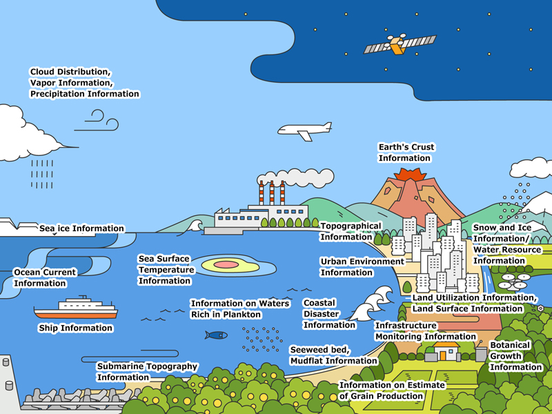
Remote Sensing has various methods. Investigation through the use of proper sensors equipped on satellites is called Satellite Remote Sensing. Sensors equipped on satellites observe electromagnetic waves emitted from the sun or from the satellite itself reflected by the sea, forests, cities, and clouds. The following can be inferred from the obtained data.
- Vegetative conditions : Deforestation, desertification, agricultural status
- Land surface temperatures : Heat island phenomena
- Sea surface temperatures : The meandering of the Japan Current, El Nino events, estimation of fisheries
- Surface altitudes : Mapping
- Clouds : Weather forecasts, precipitation predictions, inner conditions of typhoons
- Water : Reservoir volumes, flood damages