Shibuya redevelopment project 2023.04.19
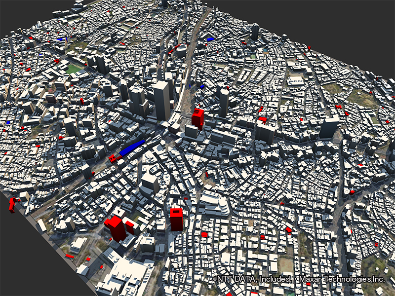
The streetscape of Shibuya, which is significantly transformed by redevelopment, is represented by the 3-time period "AW3D Building 3D Data".
Buildings that increased between 2017 and 2019 are shown in blue, and between 2019-2020 are shown in red.
The U-shaped red building in the center of the screen is the SHIBUYA FUKURAS (former site of TOKYU PLAZA), which was completed in 2019.
It can be seen that many new buildings were constructed in the Shibuya area in just four years.
Shibuya developed greatly following the Tokyo Olympics in 1964, and since the 1970s, it has been the center of youth culture and has produced a variety of cultures.
However, the complex station structure and the fact that the town is divided by the railroad and National Route 246 made the development of flow lines a problem.
To improve these issues and further develop this area, approximately 10 redevelopment projects have been launched jointly by the public and private sectors for the greater Shibuya area.
Satellite data can be used to visualize wide-area changes over a long period in an easy-to-understand manner.
AW3D's highly accurate 3D topographic and building data is useful for urban management and development tasks, such as understanding the growth rate of urban space and the rate of space sufficiency.
| Location | Shibuya,Tokyo (Japan) |
|---|---|
| Satellite / Satellite imaging product | AW3D Standard 5m, AW3D Ortho Imagery |
- Related Links