Kanto Plain, Japan2023.02.27
In winter, Niigata and other areas on the Sea of Japan coast receive a lot of snow, while the Pacific Ocean coast enjoys clear skies.
This is because winds blowing from the Siberian High on the continent contain a lot of moisture at the Sea of Japan and rise against the mountainous regions of the Japanese archipelago, generating snow clouds. The dry air that has crossed the mountains blows down to the Pacific Ocean side and it is called "kara-kaze," which means a dry wind.
Let's take a look at the actual snowfall in the Kanto Plain.
The optical image (Sentinel-2) and elevation data (AW3D) are superimposed to create a movie, which visualizes the causal relationship between snowfall location and elevation by combining 2D and 3D information.
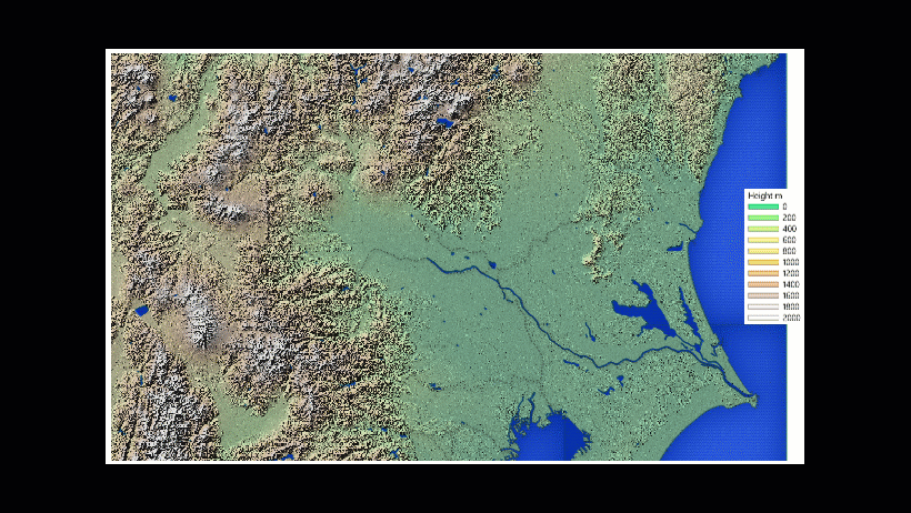
This image shows clouds (blue) over the Mikuni Mountains located on the border between Gunma and Niigata prefectures, from which snow is spreading to the Niigata side of the mountains.
The optical image shows that the area with many snow clouds is at a higher elevation.
Although satellites observe the earth with sensors of various wavelengths, it is difficult to distinguish between white snow and white clouds from the analyzed image, just as it is with the human eye.
Therefore, infrared wavelengths can be used to distinguish between snow and clouds.
In the past, such analysis required expensive software and knowledge, and satellite data was also expensive, making remote sensing less accessible to the general public.
In recent years, however, with the increase in the number of satellite launches, free data, and software have become available, making remote sensing easier and more accessible to everyone.
Why don't you also look at the place you are interested in from space? You may discover something unexpected.
RESTEC has also released VEGA, a free application that allows you to analyze free data from Landsat, Sentinel, and other sources on Google Earth Engine.
To use VEGA, please visit the related link.
| Location | Kanto Plain (Japan) |
|---|---|
| Satellite / Satellite imaging product | AW3D Standard 5m, Sentinel-2 |