Kamiya-cho, Tokyo2022.08.01
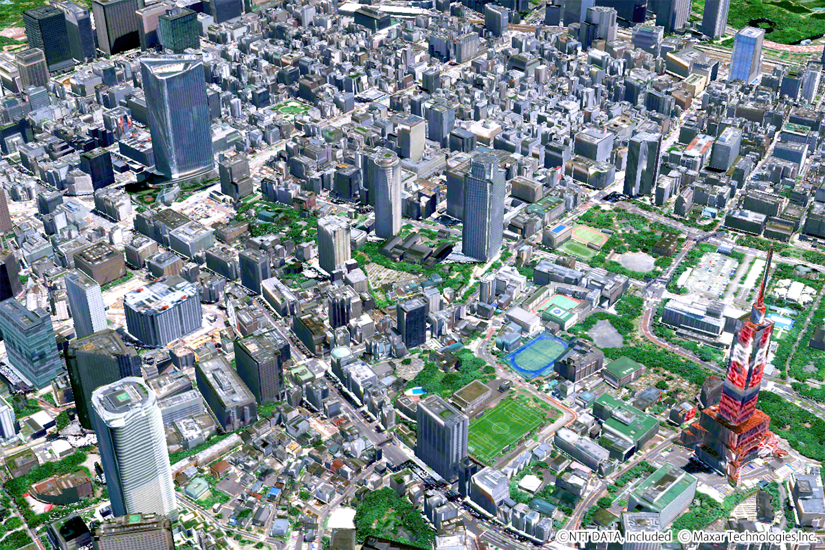
The image above, described by AW3D Building (Satellite-based building 3D vector data), shows the Kamiya-cho area in Tokyo. Also, RESTEC has headquartered here.
RESTEC had established on Aug 1st, 1975, as a foundation for the dissemination and development of remote sensing technology. (Transformed into a general incorporated foundation in 2011.) On 2022, it is the establishing 47th year since.
Earth observation by satellites began with Landsat, launched by the United States of America in 1972.
In Japan, the National Space Development Agency of Japan (at present the Japan Aerospace Exploration Agency: JAXA) established the Earth Observation Centre (EOC) in 1978 and started receiving data from Landsat-2 and Landsat-3.
RESTEC began operating image analysis equipment in 1976 and started satellite data distribution services in 1978, followed by EOC operational support services in 1979, accumulating consistent technology from operation to data reception, processing, and analysis, and playing a central role since the dawn of Japanese remote sensing technology.
Today, remote sensing technology can utilize in various fields such as disaster prevention, social infrastructure, agriculture, etc. In addition, RESTEC's business is not limited to traditional research and development but also focuses on providing solution services.
The AW3D Full Global 3D Map is 3D data that simulates the terrain, ground undulations, and the heights of trees and buildings on the Earth's surface all over the globe. And it has been utilized in 130 countries and 1,300 projects. Its use spans several fields from mapping, disaster management, resource development, and urban development to infrastructure development.
RESTEC communicates the Earth of the present times to you.
| Location | Kamiya-cho, Tokyo (Japan) |
|---|---|
| Satellite / Satellite imaging product | AW3D Building 3D data |
- Related Links