Solution Businesses
Where is your business located?
RESTEC provides solutions that match the needs of its customers, based on the knowhow it has accumulated through the reception, processing, analysis, and distribution of earth observation data within Japan and overseas.
Today, Japan is forced to confront many problems not only in the form of abnormal weather conditions, but also in the form of various natural disasters. RESTEC aims to contribute to the Japanese community and to the lives of the people by utilizing its remote sensing technologies in a wide range of areas, including the agriculture, forestry, and fishery industries, environment, disaster prevention, map information, and education.
-
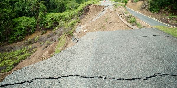 DisasterSAR images, which can be collected even at night and during stormy weather, contribute to disaster management and business risk avoidance as well as to emergency responses and disaster recovery efforts.
 -
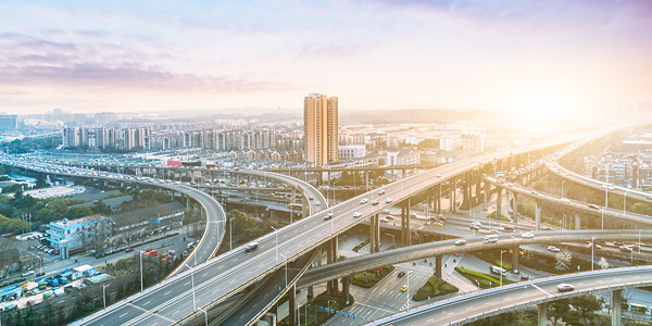 Social InfrastructureRESTEC proposes uses of technology in processes ranging from planning and constructing to maintaining roads, railways, subways, ports, airports, and more.
 -
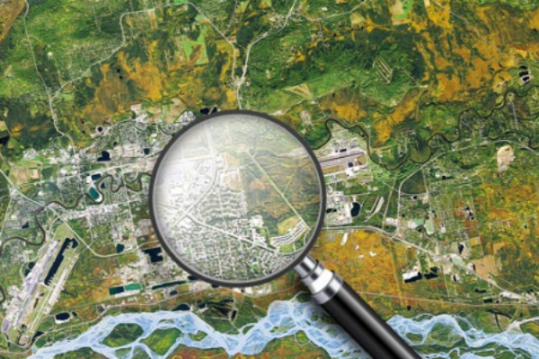
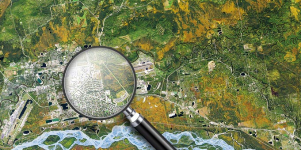
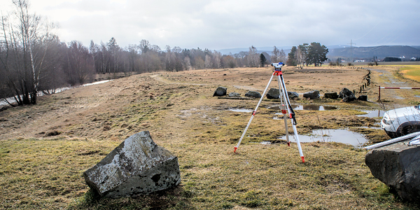 Geospatial InformationElevation data are essential for constructing structures and predicting disaster damage. Satellite data generates high-precision measurements covering the entire world.
 -
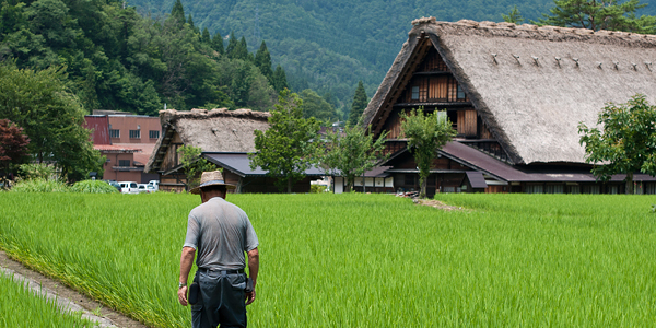 Agriculture, Forestry and FisheriesSatellite image analyses, which include analyses of the rice planting situation and crop growing conditions as well as forest distribution maps and sea surface temperature charts, support primary industries in many ways.
 -
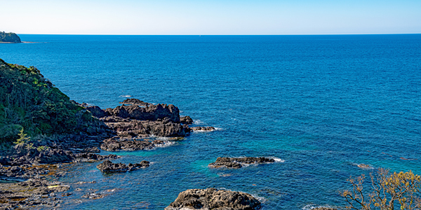 EnvironmentDistribution maps of seaweed beds, tidal flats, coral reefs, and more created from satellite image analyses make up a database designed for protecting the environment.
 -
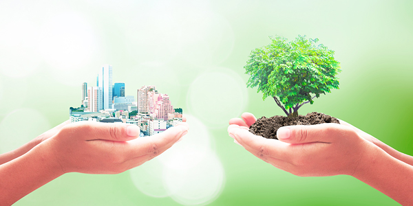 SDGsRESTEC provides satellite information for the financial services industry in order to support the livelihood of farmers as part of overseas SDGs programs.
 -
 Sale of Satellite Image DataRESTEC can introduce customers to satellite image data that best suits their purposes. We can also offer proposals on how to utilize the data.
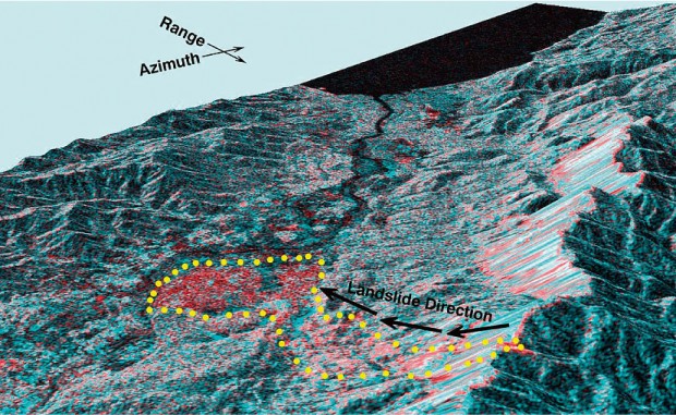
Using satellites that provide a bird’s-eye view of the overall area from distant space, various data can be acquired to assess the situation of large-scale natural disasters across a vast region. In the case of slope failure or flood disasters, the extent of damage can be made known by observing changes in the nature of light reflectance or of radio wave scattering associated with ground-surface changes caused by sediment and/or water overflows.
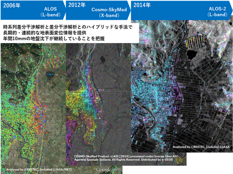
Technologies can analyze images obtained from satellite-mounted synthetic aperture radars to take millimeter-order measurements of ground surface displacements from past to present and future. These technologies can be used to assess ground surface displacements at locations where humans could not go to take measurements or at multiple locations stretching over a wide area that are costly to measure using other means. The technologies have begun to be used for many infrastructure construction and maintenance works, including roads, railways, ports, and airports.
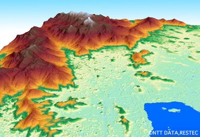
Using satellite data that provides high-resolution measurements of a wide area, customers can obtain maps at a scale of 1:25,000, information on global terrain and ground undulations, and data on the height of trees and buildings on the earth’s surface. This information has broad usage, including mapping, disaster management, resource development, urban development, and infrastructure development. The information has already begun to be used in cutting-edge domains, such as 5G mobile phones networks and autonomous driving.
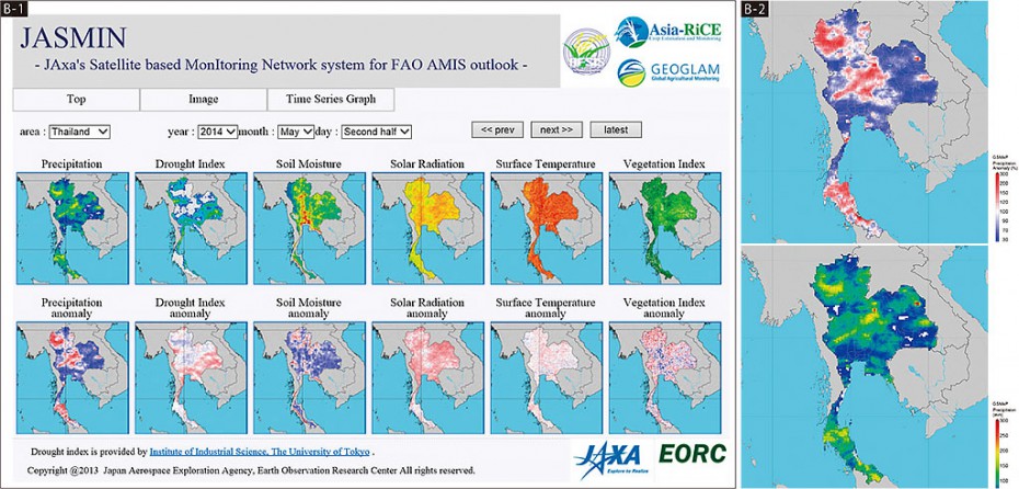
Typhoons, localized downpours, droughts, and other extreme weather events are occurring with greater frequency. Against this backdrop, using satellite data to grasp the current situation and make predictions is expected to contribute to quick actions in the agriculture, forestry and fisheries industries. In agriculture, efforts are made to estimate rice crop prospects by drawing on agricultural weather information obtained through remote sensing. This information is being shared throughout the world through the Agricultural Market Information System (AMIS).
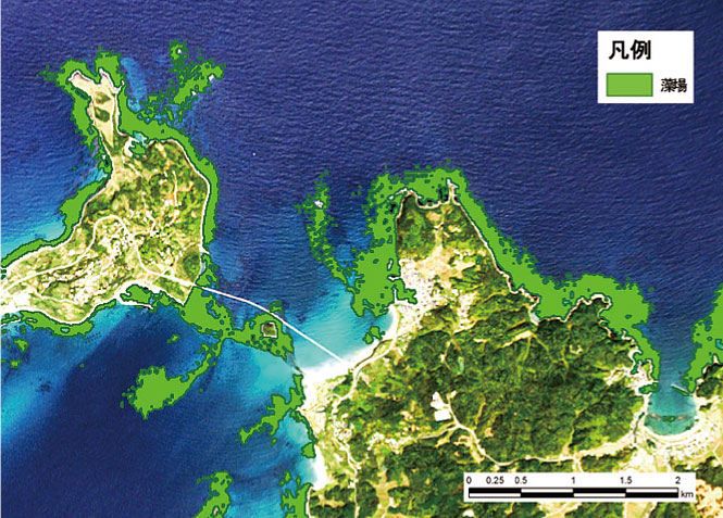
Seaweed beds made of seaweed communities are likened to an ocean forest and have a vital role as the feeding, egg-laying, and breeding sites for many types of marine life. However, the decline of seaweed beds has been reported in Japan and elsewhere in the world owing to various causes, including reclamation, eutrophication, and global warming. To maintain biodiversity and manage fishery resources, it is necessary to monitor and engage in efforts to protect and restore seaweed beds. Reference: Fisheries Agency, “Japan Coastal Kelp Forest Regeneration Monitoring Project”
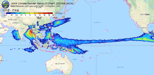
Precipitation data is one type of information that can be obtained from earth satellite observation. As a way to contribute to science and technology innovations for achieving the Sustainable Development Goals (SDGs), satellite precipitation data is beginning to be used in the insurance sector to calculate disaster damage and design new insurance services in order to protect farmers.
It is not easy to purchase the best data since satellite characteristics, such as resolution and observation frequency, as well as data provision methods vary by satellite. RESTEC can introduce customers to satellite data that best suits their purposes and offer proposals on how to utilize the data.