Use Case
SDGs
Remote sensing technology contributes to the Sustainable Development Goals (SDGs)
Adapting to climate change
-
Using satellites, coastal terrain information (land side and seabed) can be obtained and provided without any constraints, even in island countries that are comprised of islands scattered across a wide area.
In South Pacific island countries, this coastal terrain information is used to create and demonstrate hazard maps for cyclone-induced high waves and high tide, taking into account predictions on the climate change response (Fiji, Samoa, etc.) -
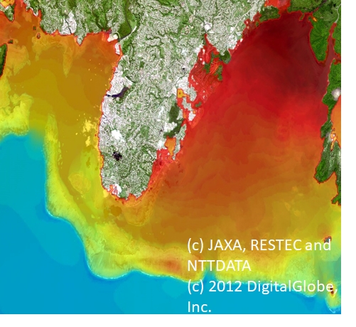
Suva, Fiji Hazard Map (Inundation) For Future (2061-2080) under RCP 8.5