Maps and Urban Planning
Maps have become indispensable to our lives and activities, so much so that map apps are often cited as an frequently-used app of Japanese smartphone users in Japan, a country where each person now owns one smartphone. We utilize maps as a foundation to gain a picture of the overall situation, to design and implement an ideal urban plan, and to evaluate and study its outcomes. RESTEC provides satellite images as “photo maps.” We also offer a service that extracts various data from satellite images and use it to create and provide thematic and business maps. In more and more cases, satellite data that can be collected periodically over a wide area are utilized as new fixed-point observation data (new map data) in a wide range of fields, including infrastructure, construction, agriculture, forestry, and oceans.
Map
An increasing number of customers are using satellite images and topographic maps created from satellite images as new maps that provide a great detail of a location without going there. A major feature of satellite images is that they offer high resolution (currently up to 30 cm resolution) imagery of the situation at the time that it was taken. A satellite image mosaic can be called a basic (photo) map that covers a wide area (Example 1). DSM (Digital Surface Model) and DTM (Digital Terrain Model) contours can be imported into CAD or GIS software through 3D maps that show the location’s terrain undulations and the shapes of trees and structures. In this way, 3D models can be created easily (Figure 2). Furthermore, by making use of Artificial Intelligence (AI) and Machine Learning (ML) technology, we have enabled automated feature recognition and automated map processing from satellite images. Figure 3 is an example of automatic extraction of house shape data (footprints) and road lines from satellite images.
-
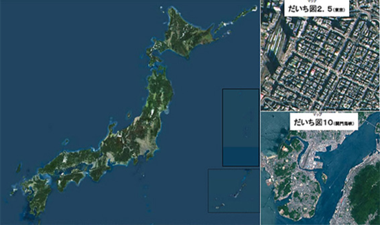
Figure1 Daichi Map -
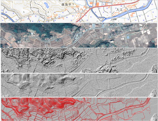
Figure2: Geospatial Information Authority of Japan, satellite image date(30cm resolution), DSM(0.5m resolution), DTM(0.5m resolution), Contour(1m resolution) -
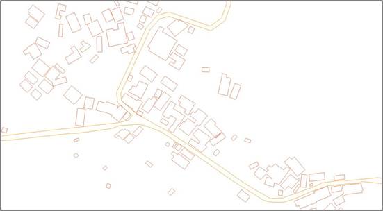
Figure3 Building footprints and road lines extracted from satellite image date