Snow day in Tokyo January 23, 20182023.01.19
From January 22 to early January 23, 2018, a low-pressure system passed over the southern sea of Honshu, resulting in heavy snowfall, particularly in the Kanto region.
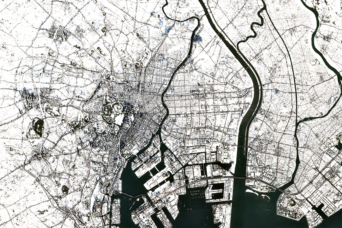
The image shows Tokyo imaged by Sentinel-2 on January 23, 2018.
Optical satellites are often unable to capture images during rain and snowfall due to cloud cover, but on this day, the sky was clear after the heavy snowfall, so it was able to obtain an image of a silvery white Tokyo.
You can see the shadows of the TOKYO SKYTREE and the Shinjuku skyscrapers stretching over the snow.
According to the Japan Meteorological Agency's records, Tokyo's snowfall that day was 23 cm, second only to the 27 cm record set in 2014.
Furthermore, note that from 2000 to 2021, there have only been two times (2014 and 2018) when the deepest snowfall of 10 cm or more had recorded.
One of the causes of heavy snowfall in the Kanto region is a south coast low-pressure system that moves off the southern coast of Honshu.
This low pressure usually occurs almost in January and February, and the same pressure pattern had observed during the snowfalls in 2014 and 2018.
In addition to ground-based observation networks such as AMeDAS, Japan's weather has been observed by the weather satellite Himawari at a high frequency every 10 minutes (observation range).
Satellite weather observation that began in earnest on April 6, 1978, has become an indispensable part of our daily lives.
| Location | Tokyo (Japan) |
|---|---|
| Satellite / Satellite imaging product | sentinel-2 |