Mt. Fuji – coming to Climbing Season2022.07.10
Mt. Fuji is the highest mountain in Japan.
On July 10, 2022, the three trails on the Shizuoka Prefecture side and the Summit crater loop of the mountain opened, ten days after the Yamanashi Prefecture side.
From this day, the beginning of the full-fledged climbing season.
Mt. Fuji is a symbol of Japan, and there are more than 400 so-called "local Fuji" in various regions. For example, Mt. Hiei in Kyoto is known as "Miyako Fuji".
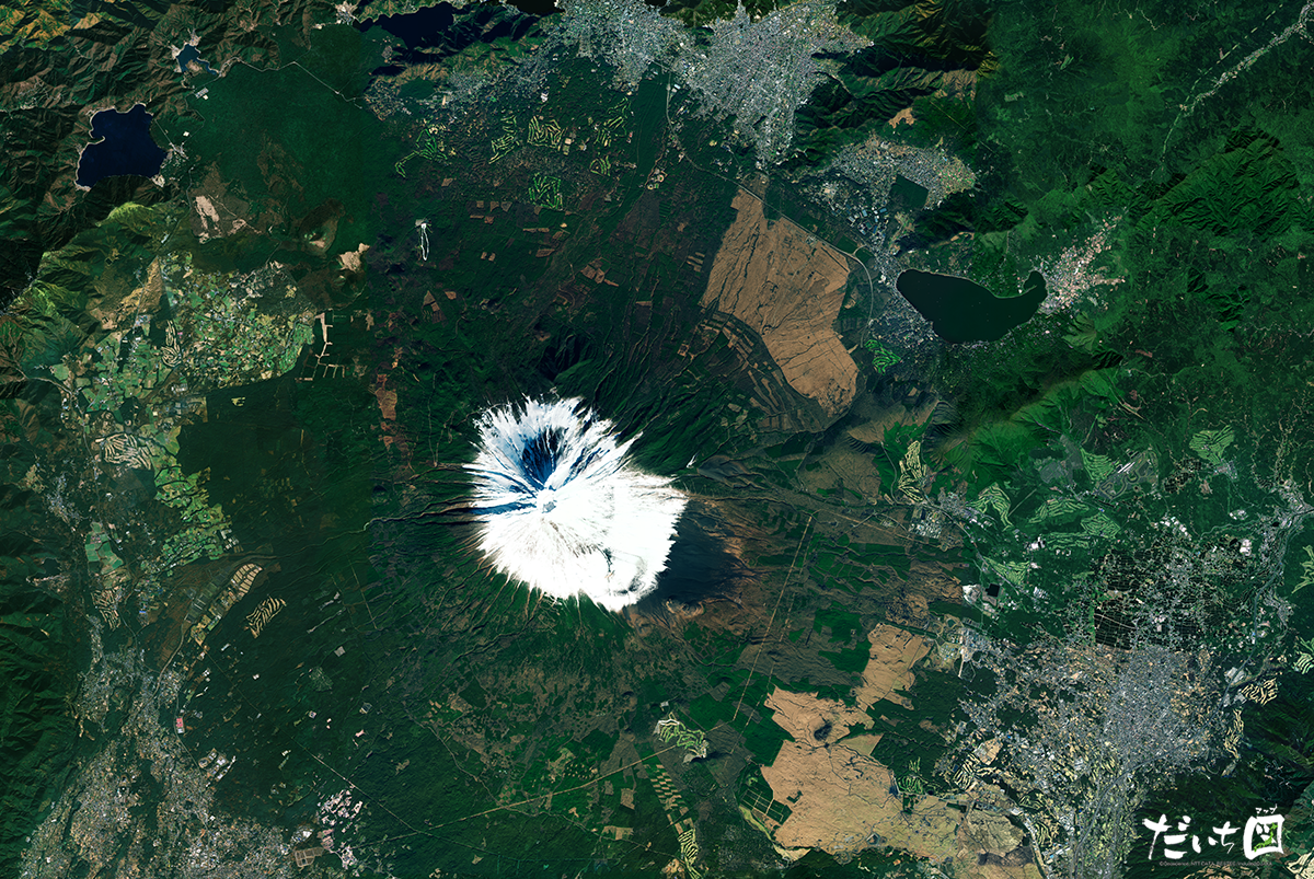
Although the beautiful ridge line cannot look at from satellite images, the dignified white snow-capped peak and the Fuji Five Lakes can look north of the summit.
The large crack extending westward from the summit is the Osawa Failure .
Although the date of formation is unknown, this failure, estimated to have caused a wholesale landslide about 1,000 years ago, is still ongoing. Therefore, erosion control measures are to take for disaster prevention in the fan-shaped area formed below it, where mudslides and other collapsed materials have accumulated.
Daichi Map is a satellite image representation of the Japanese archipelago.
It combines over several hundred scenes from the vast amount of imagery observed by ALOS, removing image distortions and unifying the color tones to create a beautiful representation of Japan.
| Location | Mt. Fuji (Japan) |
|---|---|
| Satellite / Satellite imaging product | Advanced Land Observing Satellite (ALOS) / Daichi Map |